The Seven Shires Way is a 234 mile long walk around the Oxfordshire county boundary. The route criss-crosses the boundary taking the walker into seven shires from Gloucestershire to Oxfordshire, Warwickshire, Northamptonshire, Buckinghamshire, Berkshire and Wiltshire.
The path passes through a wide variation of scenery: from the marlstone scarp slope of Edgehill in Warwickshire to the ironstone villages of North Oxfordshire, the clay vale of Aylesbury, the beech woods of the Chiltern Hills, the riverbank of the Thames, the open downland of Berkshire and Cotswold villages in Gloucestershire.
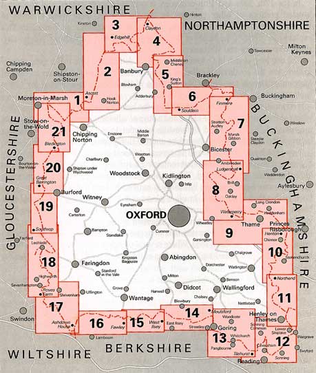
This book divides The Seven Shires Way into twenty-one sections, all of which have suggested access points for shorter distances and car parking locations. Each walk is accompanied by the relevant section of the Ordnance Survey map and is vividly illustrated throughout, giving the archaeological, historical, botanical and literary detail.